Clean Water Act: 50 years, 50 facts

Clean Water Act: 50 years, 50 facts

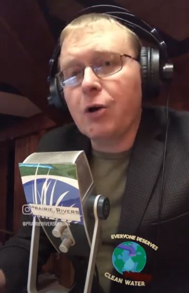
 “The Clean Water Act: 50 Years, 50 Facts” will be a weekly series of short videos on our Instagram and YouTube channels, celebrating the 50th anniversary of the Clean Water Act, and focusing on rivers and lakes in Iowa.  At the time I wrote this, we had published the first four episodes and recorded material for the next four.

The Clean Water Act is a law that works best when concerned citizens are paying attention and speaking up, so it’s worth the trouble to make sense of legal jargon like a point source, 303(d) list, 319 grants, NPDES permits, and the ordinary high water mark.  Yikes! We’ll cover these topics and more in accessible and bite-sized chunks!

Environmental policy can be a dry subject, so we’re having some fun with it!  I take full responsibility for the theme music, inspired by a Steely Dan hit that debuted a month after the Clean Water Act.  You can thank Daniel Huber and Mike Kellner for making the videos pretty and putting them out there; I’m clueless when it comes to social media.

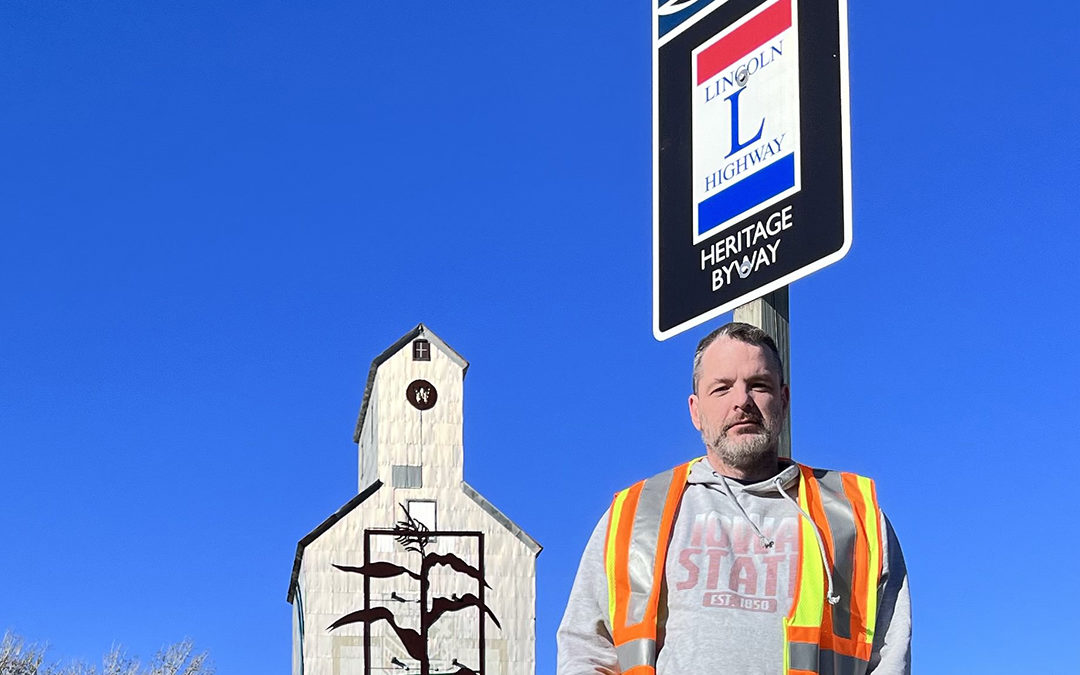
The videos are less than 90 seconds and are best viewed on a smartphone in portrait mode.  The first few were me talking from my office, but I’ve already started taking field trips (Fact #6 was filmed in front of an effluent pipe) and I hope to feature guests whose job or advocacy work intersects with the Clean Water Act.

The Clean Water Act is a big law.  I know a lot about some pieces and very little about other pieces.  My reference books for the series will be EPA’s Watershed Academy Web and River Network’s Clean Water Act Owner’s Manual.  If I overlook something, you’ll hear from my “fact-checker” in the description or comments section.

Clean Water Act Owners Manual

I want this to be relevant, so I will sometimes follow up on a fact with some commentary or include a link to policy recommendations from other organizations.  For example, here’s a report from the Environmental Integrity Project on how to close the gap between the CWA’s goals and reality. Yes, I work for an environmental organization and we would like some more environmental protection, please.

However, I can understand why many people see environmental regulation as burdensome.  I hope that a better understanding of how the system works (or doesn’t work) could help us find some common ground.  My perspective on environmental law is informed by a stint at the Wisconsin Department of Natural Resources where I learned how complicated it can be to fill a small amount of wetland legally, and how often people got away with filling a large amount, illegally.  What if fewer projects needed a permit, but we had tougher enforcement?  Wouldn’t that save more wetlands on balance, while leveling the playing field and reducing compliance costs for most businesses?

And if common ground is out of reach in today’s political climate, hey, it’s just some short videos.  Enjoy!

Lincoln Highway National Heritage Byway Sign Inventory Completed

Lincoln Highway National Heritage Byway Sign Inventory Completed

As the Lincoln Highway National Heritage Byway coordinator, I recently had the privilege of seeing every corner of the Byway from the Missouri River to the Mississippi River — crossing every river in between. The Iowa Department of Transportation (IDOT) asked byway coordinators to inventory every byway sign on their respective byways across Iowa. For me, that meant 1100 miles, including both sides of the road, and the loops through downtowns. The goal was to complete the inventory before winter begins. We finished just before the big pre-Christmas storm in 2022.

Overall the signs are in good condition and help tell the story of the Byway. But in areas, they go missing, especially where there has been redevelopment along a main street or where new highways have been expanded. Some signs even have a few bullet holes in them. IDOT now has the location and condition of all Iowa Lincoln Highway National Heritage Byway signs so improvements can be made.

Lincoln Highway National Heritage Byway Coordinator Jonathan Sherwood

I can’t take all the credit. I had the benefit of having a Prairie Rivers of Iowa volunteer to switch off data entry and driving. My job would have been made much more difficult without a helper who was so thoughtful and thorough. It also made it easier to take in the beautiful landscape along the journey.

We chose to do the inventory on the weekends from October to December and were witness to the seasons changing. Not only that each town had its own charm and many were decked out for the holiday season. One afternoon an awe-inspiring fog frosted the countryside and town trees. Garland, lights, wreaths, and bows adorned lampposts and store frontages along brick-paved streets. This is not to mention the tenderloin and loose meat sandwiches along the way. (Pictured: Taylor’s Maid-Rite in Marshalltown)

Some folks call Iowa flat, but if you travel the Lincoln Highway in Iowa you’ll see it’s not. In Pottawattamie County, the Lincoln actually goes from north to south for a segment where you can see the sculpted deposits as peaked hills with narrow ridges as the windblown Loess Hills between the divide of the Missouri River Alluvial Plain.

I’m a native Iowan but have never had the opportunity to see Iowa in such a way. The Lincoln Highway Heritage Byway traverses landscape changes from west to east from its landforms. There’s the Missouri River Alluvial Plain, Loess Hills, Southern Iowa Drift, the Des Moines Lobe, Iowan Surface, and East-Central Iowa Drift Plain.

Along the way, Iowa’s byways crisscross, adding to the allure of America’s Byways® in Iowa. One way to understand Iowa and its cultural and natural resources is to travel along its byways. That’s why byway signs are so integral to telling Iowa’s story. They are part of the deep heritage of wayfinding that began in the 1910s with telephone pole paintings and Boy Scout markers.

Iowa Winter Scenes Along the Lincoln Highway National Heritage Byway Corridor

Mount Crescent Ski Area Along the Lincoln Highway Corridor

Mt. Crescent Ski Area in Honey Creek

Lincoln Highway Farm Scene near Carroll Iowa

Farm Scene Near Carroll

Niland's Corner Along Lincoln Highway in Colo Iowa

Historic Niland’s Corner Near Colo

Bonus Video

You can lead a horse to water…

You can lead a horse to water…

Prairie Rivers of Iowa is not the sort of environmental group that follows the goings on at the state capitol (that would be our friends at the Iowa Environmental Council) but the success of our watershed projects is very much affected by state and federal policy.  A big part of our work is environmental education, but often “is a river still polluted and what can we do about it” is a legal and political question as much as a scientific question.  I hope this tricky case study from the Cedar River will illustrate why we need more people to learn about and talk about environmental policy to make it more transparent, fair, and effective.

My New Year’s resolution for 2023 is to write fewer long articles like this one and more bite-sized lessons.  For the 50th anniversary of the Clean Water Act, we’ll be sharing 50 short facts (one a week) on social media about that important and complicated law.  Here are the first five:

1) The Clean Water Act (CWA) is 50 years old but it still has a big influence on how we evaluate and protect water quality in rivers and lakes.

2) The Clean Water Act is a federal law but is implemented at the state level, with oversight from the Environmental Protection Agency (EPA). In Iowa, the Department of Natural Resources (DNR) is responsible for issuing permits, setting standards, and assessing the condition of rivers and lakes.

3) The Clean Water Act requires public notice and public comment for many decisions. Staff at environmental agencies read and take seriously public comments, so it’s worth speaking up and having your voice heard.

4) The Clean Water Act also gives concerned citizens the standing to file suit if there is an ongoing violation that hasn’t been enforced, or if the Environmental Protection Agency is not fulfilling its mandatory duties.

5) Decisions by courts and federal agencies can come into conflict with state legislatures, which control the budgets for state agencies. For example, in Iowa there are over 700 river segments and lakes on the waiting list for a cleanup plan, because Department for Natural Resources doesn’t have enough staff to keep up with it.

We can sum that up with the old saying: “You can lead a horse to water, but you can’t make it drink.” 

In November, the Iowa Department of Natural Resources (DNR) made the unusual decision to withdraw a cleanup plan (or TMDL) for nitrate in a part of the Cedar River that supplies drinking water to Cedar Rapids.  Click here for the original plan, here for the public notice of its withdrawal, and here for the Iowa Environmental Council’s response, which provides some valuable context.  TMDL stands for “Total Maximum Daily Load.”  TMDLs are pollution budgets that explain where pollution is coming from and how much needs to be reduced in order to protect fisheries, drinking water, or recreation in an impaired river or lake.  They are often used to set permit conditions for upstream sewage treatment plants and industrial facilities.


leading a horse to polluted water in the the Cedar River

There is a joke that TMDL stands for “Too Many D*** Lawyers.”  Most state agencies ignored the part of the Clean Water Act dealing with TMDLs until a series of lawsuits by environmental groups in the 1990s.  The Cedar River TMDL was actually written under a court order in 2006.  The TMDL estimated that only 9% of the nitrogen in the Cedar River watershed was coming from regulated point sources of pollution like sewage treatment plants and factories.  Most of the reductions would need to come from agriculture, through voluntary conservation programs.  Still, the plan called for capping the pollution from point sources at the 2006 amount and not adding any more.  However, it seems that the DNR did not follow the TMDL when writing permits over the next decade, and did not enforce permit violations.

One of the most surprising violations is from a drinking water treatment plant in Waverly.  I don’t think of drinking water treatment as generating pollution, and maybe that’s why it was initially overlooked.  The facility uses reverse osmosis, which gives you cleaner water on one side of the membrane and dirtier water on the other side.  The facility has been discharging wastewater with 37.7 mg/L of nitrate into the Shell Rock River (a tributary of the Cedar).  When the DNR added a permit condition that nitrate be brought down to 9.5 mg/L, the Iowa Regional Utilities Association protested, claiming that compliance would cost them $1 million.  If my math is correct, bringing the facility into compliance would avoid only 5 tons of nitrogen pollution per year.  The TMDL calls for a reduction of 9,999 tons per year.  Enforcing this permit as written does not seem like a fair or effective way to protect water quality in the river, but I suspect there would be an easy fix if the TMDL were revised.

The Clean Water Act provides two ways to set the limits in a permit.  Water quality-based effluent limits reference the pollution budget in a TMDL.  They’re only for facilities that discharge to an impaired water body.  Technology-based effluent limits are set statewide, based on the level of treatment that’s possible with widely available, not-too-expensive technologies. The Iowa Nutrient Reduction Strategy included new technology-based effluent limits for nitrate and phosphorus, affecting 157 municipal and industrial wastewater treatment systems.  They must find a way to reduce their total nitrogen by 66% and their total phosphorus by 75% or else complete a feasibility study to show it would be cost-prohibitive to do so.  Some facilities are already making the upgrades, some won’t be done until 2027.  For the largest point source in the TMDL (the Waterloo sewage treatment plant), that means a reduction of some 333 tons of nitrogen a year.

Effluent from a wastewater treatment plant entering a river.

Of course, most of the nitrate reduction goal for the watershed (9,999 tons) will need to come from agriculture.  We don’t know how that’s going because Iowa doesn’t have a current or complete tracking system.  The most recent data I could find for cover crops by watershed is 7 years old.  At that time, there were not enough acres to make a noticeable difference in water quality in the river.

Cover crops in the Cedar River watershed
Cedar River watershed map, courtesy of IIHR

Side note: The Cedar River starts in Minnesota and has several major tributaries, including the Shell Rock River, West Fork, and Winnebago.  It’s a big watershed that usually gets divided into smaller chunks (i.e. there are separate watershed management authorities for the Upper, Middle, and Lower Cedar).  The TMDL actually recommended prioritizing conservation in the Upper Cedar, but at some point, the focus got shifted to the Middle Cedar.

Are water quality based-effluent limits still needed?  Maybe not, but the frustrating thing about this case is that we get don’t get a revised pollution budget that shows how other strategies will protect drinking water in Cedar Rapids.  We don’t get a public debate over what’s not working with this law and an opportunity to change it.  Instead, we get excuses for why a revised TMDL can’t be done and isn’t needed.  Some of those excuses are legitimate: the chronically underfunded DNR has a lot of TMDLs to write and not enough staff to do it.  Some of the excuses are flimsy: apparently, the document mishandled nitrogen units in a way that was too subtle for me to notice on the first read-through but serious enough to make the whole thing unworkable.

Another excuse—that the Cedar River is no longer impaired—seemed like a mistake at first but turned out to be technically correct on closer inspection.  “No longer impaired” means that fewer than 10% of the samples collected during the last two assessment periods (2016-2018 and 2018-2020) exceeded the drinking water standard.  I’ve double-checked this with another source of data and think this assessment holds up, even if we account for weather.  It’s just premature.  Nitrate was back up in 2022.

nitrate violations in the Cedar River

Well, you know what they say.  You can lead a state agency to water, but they can’t make it drinkable.

(Apologies to my respected colleagues at DNR.  I can’t resist a good pun!)

How to Plant a Prairie Strip: One Landowner’s Journey

How to Plant a Prairie Strip: One Landowner’s Journey

Just a few weeks ago, the hope of tomorrow was seeded in the middle of an empty field.

Chuck Waving from Tractor

Chuck and his neighbor, Henry, waving as they start planting prairie in Chuck’s waterway.

I turned my dusty Ford Ranger off a quiet two-lane highway in Marshall County into a dead grass waterway, soon to be planted with native prairie seed. I pulled up next to Chuck’s vehicle.

“Well, today’s the day, isn’t it,” he said, smiling despite the icy November wind. We were finally putting seed in the ground.

A Rough Start

It can take more effort than you think to plant a prairie in a grass waterway. Firstly, Chuck Stewart, of Ankeny, doesn’t live in Marshall County; he rents his field to a farmer, who plants traditional crops like corn and soybean. Secondly, the grass waterway was planted with smooth brome (a tough European grass), making it difficult to plant anything else in it. Lastly, the previous landowner had created the grass waterway without using any government programs. This last fact made it difficult to qualify for USDA programs to help fund the cost of planting a prairie strip in the waterway. Many NRCS and FSA (Farm Service Agency) programs stipulate the ground must be currently in production to receive funding. Landowners who don’t qualify for NRCS and FSA programs, like Chuck, can have a difficult time finding programs to fund prairie projects on their land.

“The reason I started this prairie project was to establish a site that will draw not only pollinators but all kinds of wildlife,” said Chuck. In order to do this, he needed expertise from environmental-based organizations, such as Prairie Rivers of Iowa.

Drilling the Seed
Discussion by Tractor

Finding a Way

Although he could not receive funding from traditional USDA programs, Chuck did, however, have a few things going for him. He initially had David Stein, a former watershed coordinator at Prairie Rivers, conduct a site visit and create a restoration plan.

“Prairie strips [are] one of the best ways farmers can get into conservation practices and habitat building,” David Stein said when asked about this project, “You’re taking unproductive land out of intensive use and replacing it with a small area that provides amazing benefits for the farm and surrounding environment.” For Chuck, some of those benefits include a reduction in runoff and erosion, increased water infiltration, and of course the perennial beauty of native prairie, pollinators, and other wildlife.

Additionally, Chuck was able to secure a 50% cost share from the Prairie Partners Program to reduce the expense of native seed. Chuck also had a neighbor, Henry, who had some prairie-planting experience and owned a native seed box for his tractor. Having a willing, experienced neighbor to help plant and manage the future prairie made this project much more cost-effective than hiring someone out of town.

Lastly, Chuck and I met with Dan Allen, the owner of Allendan Seed Company, to see the operation that supplied his native prairie seed. After viewing giant warehouses of seed, expansive fields of prairie plants, and a large greenhouse, we discussed how to help the prairie outcompete the smooth brome currently in the grass waterway. Knowing it may take a few years to truly defeat it, we decided to mow the smooth brome and hit it with two rounds of glyphosate, at about a month apart, before planting the prairie seed in the fall. We also added another seed mix in addition to the one cost shared with the Prairie Partners Program. While this was an out-of-pocket expense, planting higher than the minimum of 40 seeds per acre, as well as increasing plant species richness, will hopefully provide faster and stronger establishment, giving the prairie a greater chance at success in the long run.

The Seed

Seeds of Hope

As Chuck stepped down from the tractor at the end of planting, it was hard to imagine that the dull-gray strip of land would one day be full of color and life.

“We did it!” He said with a grin, “I hope the neighboring farms will see the results and consider planting prairie themselves.” It is our hope that more farmers will see the value of turning silent areas into vibrant habitat, with bird calls, bees, and dancing flowers breaking the monotony of row crops.

If you are interested in implementing prairie on your property, and are unsure of where to start, contact Jessica Butters, Pollinator Conservation Specialist, at Prairie Rivers of Iowa, HERE.

Many Thanks:

“In summary, I want to thank Prairie Rivers of Iowa staff David Stein and Jessica Butters. David developed a detailed plan outlining the process, and Jessica prepared an outline for the timing of each step, from preparing the seedbed to the ongoing steps of maintaining the prairie.” – Chuck Stewart

We would also like to thank Henry Rolston, Allendan Seed Company, Jon Judson, and Ty Mason.

The National Register of Historic Places

The National Register of Historic Places

The National Register of Historic Places, or NRHP, is a federal program administered by the US National Parks Service (NPS).  It was created in 1966 as part of the National Historic Preservation Act (NHPA) to recognize cultural resources that, whether intentionally or accidentally, had withstood the tests of time and human action.  No legal obligations – for owners – are imposed by being listed on the NRHP.  For them, it is an honorific program.

The NRHP places nominations and listings into one of five categories: buildings, structures, objects, sites, and districts.  The most common listings are buildings and districts, or groups of buildings (more on structures, objects, and sites below).

National Register of Historic Places Plaque

The NRHP recognizes four kinds of historic value: association with significant events, association with significant people, outstanding exemplars of architecture, and/or the potential to yield important historical or prehistorical information.

The NRHP places nominations and listings into one of five categories: buildings, structures, objects, sites, and districts.  The most common listings are buildings and districts, or groups of buildings (more on structures, objects, and sites below).

Nominations to the NRHP document many aspects of a place, including its current condition, remaining design features that indicate that it is historic, its own history (in the case of a building, for example, documentation of expansions or renovations), and its historic context.  Nominations provide this information textually and with images such as maps and photographs.  They are written using a wide variety of historic resources – fire insurance maps, newspapers, Census and other genealogical records, any available historic images, archival collections, secondary sources produced by historians, and even other nominations.

The NRHP places nominations and listings into one of five categories: buildings, structures, objects, sites, and districts.  The most common listings are buildings and districts, or groups of buildings (more on structures, objects, and sites below).

Brick Street Historic District Woodbine, Iowa

Youngville Cafe

Youngville Cafe Watkins, Iowa

Lincoln Highway Bridge

Lincoln Highway Bridge Tama, Iowa

Lincoln Hotel Lowden Iowa

Lincoln Hotel Lowden, Iowa

The NRHP requires that nominated properties have integrity – that they themselves convey their historic character and significance themselves.  The NPS breaks integrity down into seven elements: location, design, setting, materials, workmanship, feeling, and association.  Some of these elements are more subjective than others, but over the years the NPS has written many National Register Bulletins now available online, which explain their meaning, the procedure for preparing nominations, and other questions related to historic preservation.

In addition to recognizing historicity, the NHRP provides a framework for how public resources and regulations are allowed to affect the United States’ cultural resources.  Whether a place is listed or eligible for listing informs the federal government’s actions, as do the professional and work standards set forth by the Secretary of the Interior, who oversees the NPS.  The Secretary of the Interior’s Standards guide projects that preserve, rehabilitate, restore, and/or reconstruct historic cultural resources.  As with the National Register Bulletins, these are available online.

A private owner of a place listed on the NHRP is most likely to encounter regulation when they obtain or try to obtain a financial benefit from the federal, state, or local government.  At the federal level, a 20% federal income tax credit is available to recoup up to 20% of the money spent on a certified project to rehabilitate an income-producing building that is certified as historic by being listed individually on the NRHP or by being in an NRHP historic district.  The State of Iowa offers a 25% tax credit for “qualified rehabilitation expenditures” to preserve historic buildings’ architectural elements that give them their historic character.  Counties also may offer exemptions from a few years of property tax increases that result from the value added to historic properties by performing rehabilitation projects.  In all cases, these benefits must be applied for through an officially designated procedure.  The projects they support must be “sensitive” according to the Secretary of the Interior’s Standards.  And the affected places must be recognized as historic.

The NHPA imposes similar obligations on the federal government itself – and the spending of federal money or issuing of federal permits.  According to Section 106 of the NHPA, federal “undertakings” – projects that spend federal money or use federal permits, including state, local, and private projects – must evaluate the effect of their proposed work on any places listed on the NRHP or that are eligible to be listed on it, and avoid or mitigate adverse effects.  Section 110 of the NHPA requires federal agencies to manage the historic preservation of their own resources using the guidelines of the NRHP.  Finally, section 402 of the NHPA requires the Department of State to care for the historic preservation of US-held sites abroad if they are either a UNESCO World Heritage Site or eligible for the NHRP equivalent of the country in which they exist.

The “structures” category is one of the harder ones to define.  It is essentially human-made things, some of their buildings or building-like, that were built for some function other than providing human shelter.  The NPS gives some helpful examples, including vehicles; agricultural infrastructure like irrigation systems, canals, and windmills; and, importantly for Prairie Rivers’ survey of historic resources in the Lincoln Highway Heritage Byway, bridges.  “Objects” is a similar category, but the things defined in this way have primarily aesthetic value.  They are artistic.  “Sites” are places that are historic whether a building associated with the important historical events that happened there exists or not, or whether it ever existed.  Commonly, these are archeological digs or places where archeologists would expect to find artifacts.

Author Michael Belding is the oral history program manager for the Iowa State University Special Collections and University Archives. He previously worked as an architectural historian for the City of Mobile, Alabama’s Historic Development Commission. Currently, Belding is a Ph.D. candidate in Rural, Agricultural, Technological, and Environmental History and is working with Prairie Rivers of Iowa to help assess the condition of the approximately 319 properties listed on the National Register of Historic Places along the Lincoln Highway Heritage Byway (LHHB) in Iowa.

Author Michael Belding
Which Insects are “Home for Christmas”?

Which Insects are “Home for Christmas”?

Happy Holidays!

Insects are conspicuous by their absence during Iowa’s winter months. Absent are the beauty of butterflies, and we would be shocked to hear a bee buzzing around our snowy apartment balcony on Christmas Eve. So where did they all go? Did they perish from freezing temperatures? Have they all migrated south with the eastern monarch butterflies?

Here in Iowa, we have many insects that use truly astonishing techniques to stay here throughout the winter, braving the cold with the rest of us. From smart hiding places and suspended animation to making their own antifreeze, Iowa’s insects have developed some pretty wild adaptations to weather the winter!

Note: Iowa has many insects that undergo “suspended animation”, technically called diapause, to survive winter. Diapause is an insect form of hibernation where the insect pauses development; it stops maturing and halts all activity. It remains in its’ current life stage (which could be egg, larva, nymph, pupa, or adult) until conditions become favorable again and they can continue growing or start mating/laying eggs.

Wooly bear caterpillars: These fuzzy little guys will mature to become the Isabella tiger moth. They stare winter down by allowing themselves to freeze, but on their own terms! They seek shelter under logs and leaf layers. Once safe, they go into diapause and slow down the freezing process by creating glycerol, a natural alcohol and one of the many insect forms of “antifreeze”. They slowly allow their entire bodies to freeze except the insides of their cells.

Wooly Bear Caterpillar

Black swallowtail butterflies: These beauties stay cozy in their chrysalis while the snowflakes fall, entering diapause at the pupal stage. Their chrysalis mimics a dead leaf to keep them safe from predators, so be careful when cleaning up your lawn – especially if you grew dill, parsley, or other plants related to carrots in your garden! If you must move leaves, try not to chop/mow them to ensure you can enjoy the swallowtails next summer!

Chrysalis of Black Swallowtail

Dragonflies: Dragonflies brave the winter in a few different ways depending on the species. Some overwinter as eggs laid in logs near ponds, and others actually migrate. But one of the coolest ways some overwinter is as underwater nymphs (an immature stage of a dragonfly)! The dragonfly nymphs stay underwater beneath insulating ice layers, where they are voracious predators true to their namesake (even eating small fish!). They eat and grow throughout the winter until they can emerge as adults in the summer.

Dragonfly Larva

Flower flies: Also known as syrphid flies or hover flies, flower flies are a family of flies (called “Syrphidae”) that are fantastic garden helpers: when young they eat aphids, and as adults they pollinate. Here in Iowa, they’re commonly referred to as “sweat bees” due to their black and yellow stripes and the fact that they sometimes land on sweaty humans (sweat contains good nutrients for them). However, these flies only mimic bees, and cannot sting or bite (their mouth basically consists of a tiny mop). They survive the cold much like other insects; they find shelter in leaf layers and other plant material, enter diapause and overwinter as a larva, pupa, or adult depending on the species. Flower flies are no pansies!

Flower Fly

Bumble bee queens: Bumble bee hives only live for one year, unlike honey bees. Near the end of the hive’s life, new queens and male bees (“drones”) hatch and leave the hive to mate. When hive activity finally ends, the drones die while the newly-mated queens search for a warm winter home alone. Their new homes could be in leaf layers, warm compost piles, or just a few inches underground in a sheltered place! While winter winds howl, the entire fate of next year’s bumble bee hives rests on these young queens surviving the winter all alone. When it warms again, if all goes well, they will wake from diapause and emerge to start their very own hives to begin the cycle again.

Common Buckeye

How Can You Help?

As you can see from these few examples, surviving winter is key to us enjoying pollinators and other insects next year. So many insects rely on the shelter of leaves, logs, and other materials to block the cold wind and insulate them from freezing temperatures. Therefore, one of the best ways to help pollinators this winter, and to ensure there are pollinators this summer, is to find a place in your yard or balcony where you can let leaf litter and plant material accumulate. Think of it as a Cozy Corner that may harbor young bumble bee queens, sleeping swallowtails, and fuzzy wooly bear caterpillars. Give insects the gift of cozy this holiday season!

See below for more information on how to build your very own Cozy Corner:

Small Brush Pile

Create a “Cozy Corner”
You can create a “cozy corner”, or brush pile, for pollinators throughout the fall and winter by choosing a location to leave leaf litter undisturbed. You can add twigs, branches, and other brush to the pile as you clean up the other areas you want clear of brush. You can also leave potted plants on your balcony or patio and push them together to create a small shelter; I’ve found moths sheltering in my flowerpots in mid-fall, and I’ve noticed more bird visitors! Add layers of brush to your cozy corner to provide the best shelter possible. Click here to read the full article from which this paragraph was based on.

How-To Guides to Create Your Very Own Cozy Corner:

  • General Wildlife Brush pile: Article by the Wisconsin DNR